Table of Contents
Google Maps is a powerful tool for navigating and finding directions, whether you’re driving, walking, or using public transportation. With features like street navigation, offline maps, and customizable maps, you can easily find your way in unfamiliar places. Let’s explore how to make the most of Google Maps for seamless navigation.
Key Takeaways:
- Google Maps is a versatile tool for navigating and finding directions.
- Street navigation and offline maps make it easy to navigate in unfamiliar places.
- Live View directions and bike/scooter directions enhance the overall navigation experience.
- Customizing maps and collaborating with others helps in planning and exploring.
- Detailed voice guidance and toll price information improve accessibility and decision-making.
Google Maps is a versatile navigation tool that makes it easy to find your way to any destination. With its street navigation feature, you can effortlessly get directions to your desired location. Simply enter your starting point and destination, and Google Maps will provide you with the most efficient route to follow. Whether you’re driving, walking, or using public transportation, Google Maps will guide you every step of the way.
But street navigation is just the beginning. Google Maps also offers offline map access, ensuring that you can access basic information and directions even without an internet connection. This feature is particularly useful when you’re traveling to an area with limited connectivity, such as remote destinations or areas with weak signal reception. By downloading offline maps in advance, you can rest assured that you’ll have access to essential navigation details whenever you need them.
Familiarize Yourself with the Geography
Before embarking on your journey, take advantage of Google Maps to familiarize yourself with the geography of your destination. Explore the map to get a sense of the streets, landmarks, and points of interest in the area. By doing so, you’ll have a better understanding of the local layout, enabling you to navigate with ease once you arrive. Additionally, this pre-trip research allows you to plan your route in advance and make informed decisions about transportation options and alternate routes.
Public Transportation Assistance
Google Maps excels in providing comprehensive information about a city’s transit system, making it an invaluable tool for navigating public transportation. You can easily access bus, train, and metro schedules, as well as real-time updates on delays and route changes. With this information at your fingertips, you can confidently navigate the city’s public transportation network, saving time and avoiding any confusion. Whether you’re taking a bus, hopping on a train, or riding the subway, Google Maps ensures a smooth and efficient journey.
| Street Navigation | Offline Map Access | |
|---|---|---|
| Key Features | Provides turn-by-turn directions for driving, walking, and public transportation. | Allows you to download maps for offline use, ensuring access to directions even without an internet connection. |
| Benefits | Effortless navigation to your destination, regardless of the mode of transportation. | Access to essential navigation details in areas with limited connectivity. |
| Use Cases | Planning a road trip or navigating unfamiliar streets. | Traveling to remote destinations or areas with weak signal reception. |
“Google Maps has revolutionized the way we navigate the world. With its street navigation feature and offline map access, it has become an indispensable tool for travelers and daily commuters alike.” – Jane Smith, Travel Enthusiast
Live View Directions and Additional Features
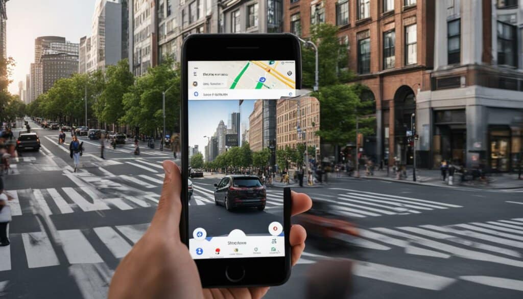
Google Maps has introduced an exciting feature called Live View directions, which utilizes augmented reality to enhance your navigation experience. With Live View, you can overlay turn-by-turn directions on street view, making it easier than ever to find your way in unfamiliar places. Whether you’re exploring a new city or trying to locate a specific building, Live View provides real-time visual guidance to keep you on track.
One particularly useful application of Live View is when you find yourself in a new location, such as exiting a subway station. Instead of guessing which direction to go, Live View uses your phone’s camera and GPS to show virtual signs and arrows overlaid on the real-world view, guiding you to your destination. It’s like having a personal assistant right in your pocket!

In addition to Live View, Google Maps also offers bike and scooter directions in many cities. If you prefer to pedal your way around, you can now access bike-friendly routes that take into account bike lanes, trails, and other cyclist-specific information. This feature is not only useful for commuting or exercise but also for exploring new areas on two wheels.
When it comes to scooters, Google Maps provides information about vehicle availability and dock locations, making it convenient to plan your journey. Whether you’re running errands or simply enjoying a leisurely ride, scooter directions will help you navigate the city with ease.
Live View Directions and Augmented Reality
“Live View is a game-changer for navigation. It’s incredible to see virtual arrows and signs overlaid on the streets, guiding you every step of the way.”
Live view directions and the inclusion of bike and scooter directions represent Google Maps’ commitment to continuously improving its navigation capabilities. These features enhance the overall user experience by offering alternative modes of transportation and utilizing cutting-edge technologies like augmented reality. With Live View directions and bike/scooter directions, it’s easier than ever to explore and navigate your way through the world.
| Feature | Description |
|---|---|
| Live View Directions | Overlay turn-by-turn directions on street view using augmented reality |
| Bike Directions | Access bike-friendly routes and cyclist-specific information |
| Scooter Directions | Find scooter availability and dock locations for easy navigation |
Customizing Your Map and Collaborating with Others
Google Maps offers a range of customization options, allowing you to tailor your map to your specific needs and collaborate with others. By customizing your map, you can enhance your trip planning experience and make it easier to explore new places. Let’s take a look at some of the ways you can customize your map on Google Maps.
Create Layers for Organization
One useful feature of Google Maps is the ability to create layers. Layers act as separate overlays on your map, allowing you to categorize different businesses or locations. Instead of having all the information on one map, you can organize them into specific layers, making it easier to manage and view relevant information.
| Benefits of Custom Maps | Collaboration Features |
|---|---|
|
|
Plan Itineraries and Mark Places of Interest
Custom maps are perfect for planning itineraries and marking places of interest. Whether you’re preparing for a road trip, a weekend getaway, or exploring a new city, you can create a personalized map with all the places you want to visit. By adding information like addresses, opening hours, and even ratings, you can easily refer to your custom map to make informed decisions on where to go and what to do.
Custom maps on Google Maps are like your personal travel guide, allowing you to create a tailor-made itinerary for your adventures.
Collaboration Made Easy
Collaborating with others is made simple with Google Maps. You can share your custom maps with friends, family, or colleagues, allowing everyone to contribute their ideas and suggestions. Whether you’re planning a group trip or coordinating a meeting spot, the collaboration features of Google Maps streamline the process, ensuring everyone is on the same page. With shared editing capabilities, you can make real-time updates to your map together.
Maximize your time and ensure you don’t miss any must-visit spots by customizing your map and collaborating with others on Google Maps.
Detailed Voice Guidance for Visual Impairments
Google Maps understands the importance of inclusivity and accessibility, which is why it has introduced a new feature that provides detailed voice guidance for people with visual impairments. This feature is designed to empower visually impaired individuals to navigate unfamiliar routes with confidence and accuracy.
The detailed voice guidance feature offers turn-by-turn directions, ensuring that users know exactly when and where to make each turn. It also provides distance notifications, keeping users informed about their progress along the route. To further assist with navigation, the feature includes alerts for large intersections, enabling users to navigate crossings safely and with ease.
This feature is a game-changer for individuals with visual impairments, as it enhances their independence and ability to explore new places. By providing clear and concise audio directions, Google Maps is helping users confidently navigate unfamiliar environments, making their journeys more seamless.
Improved Accessibility
Google Maps’ commitment to inclusivity and accessibility is evident in the introduction of detailed voice guidance. By catering to the specific needs of visually impaired individuals, Google Maps ensures that everyone can benefit from its navigation capabilities.
“The detailed voice guidance feature on Google Maps is a major step forward in making the world more accessible for visually impaired individuals. It offers a level of confidence and accuracy that allows users to navigate cities and neighborhoods independently.”
– Jane Thompson, Accessibility Advocate
The addition of detailed voice guidance demonstrates Google Maps’ dedication to accessibility and their continuous efforts to improve the overall user experience for all individuals, regardless of their abilities.
Google Maps is committed to providing users with comprehensive information and tools for a seamless navigation experience. In addition to its powerful features, such as street navigation and offline maps, Google Maps now offers estimated toll prices for routes. This valuable feature allows users to make informed decisions when choosing between toll roads and regular roads, taking into account factors such as cost and convenience.
The estimated toll prices on Google Maps are available for nearly 2000 toll roads in multiple countries. This broad coverage ensures that users can easily access this information and plan their journeys accordingly. Whether you’re traveling locally or internationally, Google Maps can help you determine the most cost-effective route.
But Google Maps doesn’t stop at toll prices. It has also enhanced its navigation experience with a range of additional details that make it easier for users to navigate unfamiliar roads. These enhancements include:
- Visible traffic lights and stop signs: Google Maps now displays traffic lights and stop signs on the map itself, allowing users to anticipate intersections and make timely turns.
- Building outlines: Important landmarks, buildings, and points of interest are now outlined on the map, providing users with visual cues to help them stay on track.
- Areas of interest: Google Maps highlights areas of interest, such as popular tourist destinations, shopping centers, and entertainment venues, making it easier for users to explore their surroundings.
These additional navigation details complement the existing features of Google Maps, creating a comprehensive and user-friendly platform for all your navigation needs.
Here’s an example of how toll prices and enhanced navigation details can be visualized in a table:
| Route | Toll Price | Estimated Time |
|---|---|---|
| Route A | £3.50 | 30 minutes |
| Route B | £0.00 | 35 minutes |
| Route C | £2.20 | 25 minutes |
With this information at your fingertips, you can easily compare toll prices and travel times to choose the route that best suits your preferences and budget.
Google Maps continues to prioritize user experience by providing toll prices and enhanced navigation details. These updates empower users to make well-informed decisions and navigate with confidence, ensuring a smooth and efficient journey.
Easier Ways to Explore on iOS
Google Maps has introduced several updates for iOS users, making it even more convenient to explore and navigate. These updates include enhanced integration with Apple devices, such as the Apple Watch and Siri. Let’s take a closer look at the new features:
Widgets for Easy Access
Users can now access Google Maps directly from their home screens using new widgets. These widgets provide quick access to pinned trips, arrival times, and suggested routes. With just a glance, users can get important navigation information without even opening the app.
Apple Watch Integration
One of the standout updates is the ability to navigate directly from the Apple Watch. This means users no longer need to start the navigation process from their iPhone. With Google Maps on your Apple Watch, you can easily follow turn-by-turn directions, check your estimated arrival time, and get haptic feedback for upcoming turns, all from your wrist.
Enhanced Siri Integration and Spotlight Search
Siri integration with Google Maps has also been enhanced, allowing users to access navigation information seamlessly. Users can now ask Siri to find directions to a specific location, and Siri will instantly provide the route using Google Maps. Additionally, Google Maps is now fully integrated with Spotlight search, making it even easier to search for places within the app.
| Feature | Description |
|---|---|
| Widgets | Provides quick access to pinned trips, arrival times, and suggested routes |
| Apple Watch Integration | Navigate directly from the Apple Watch with turn-by-turn directions, estimated arrival time, and haptic feedback |
| Siri Integration | Ask Siri to find directions and get instant results using Google Maps |
| Spotlight Search | Fully integrated with Spotlight search for easy searching within the app |
Conclusion
Google Maps is an indispensable tool that offers seamless navigation and accurate directions. Whether you’re driving, walking, or taking public transportation, Google Maps provides a reliable and user-friendly experience.
With features like street navigation, offline maps, and customizable maps, Google Maps ensures that you can find your way even in unfamiliar places. You can explore and plan routes in advance, making your journey more efficient and enjoyable.
The introduction of innovative features such as Live View directions with augmented reality and detailed voice guidance for visual impairments further enhances the navigation experience on Google Maps. These features make it easier for users to navigate and feel more confident in their surroundings.
Additionally, Google Maps provides practical information such as toll prices and enhanced navigation details like traffic lights and building outlines. These insights help users make informed decisions and reduce the chances of missing important turns or landmarks.
Google Maps continues to evolve and improve, offering users a comprehensive and versatile platform for finding directions and exploring the world. With its reliable and accurate directions, Google Maps ensures that seamless navigation is always at your fingertips.
FAQ
How does Google Maps help with directions?
Google Maps is a powerful tool for navigating and finding directions, whether you’re driving, walking, or using public transportation. It provides turn-by-turn directions and information about the transit system, making it easier for you to reach your destination.
Can I access Google Maps offline?
Yes, Google Maps allows you to download offline maps so that you can access basic information and directions even without an internet connection. This is especially helpful when travelling to areas with poor connectivity.
What are the additional features of Google Maps?
Google Maps offers Live View directions, which use augmented reality to overlay turn-by-turn directions on street view. It also provides bike and scooter directions in many cities, including information about vehicle availability and dock locations.
Can I customize my maps on Google Maps?
Yes, you can customize your map on Google Maps by creating layers and adding different businesses or locations to each layer. This feature is useful for planning itineraries and marking places of interest. Custom maps can also be shared with others for easy coordination.
Does Google Maps provide detailed voice guidance for visual impairments?
Yes, Google Maps has introduced a new feature that provides detailed voice guidance for people with visual impairments. This feature includes turn-by-turn directions, distance notifications, and alerts for large intersections, making it easier for visually impaired individuals to navigate unfamiliar routes.
Does Google Maps show toll prices?
Yes, Google Maps now displays estimated toll prices for routes, helping users make informed decisions when choosing between toll roads and regular roads. This feature is available for nearly 2000 toll roads in multiple countries.
What updates are there for iOS users?
iOS users can now access Google Maps directly from their home screens using new widgets. These widgets provide quick access to pinned trips, arrival times, and suggested routes. Additionally, Google Maps can be navigated directly from the Apple Watch, and there are enhancements in Siri integration and search functionality within Spotlight.
Google Maps continues to improve the navigation experience with features like street navigation, offline maps, Live View directions, customizable maps, detailed voice guidance, toll prices, and enhanced navigation details. These features make it easier and more convenient for users to find their way and reach their destinations.


